Browse Items (93 total)
- Collection: SKETCH 1
Sort by:
Maria McLaughlin
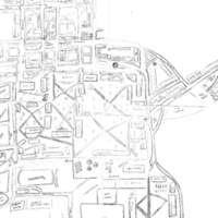
My map of Harvard took up a lot more paper than I thought it would. When I was brainstorming the individual parts on a notebook, I tended to be very detailed with the shapes of the buildings, and I made them particularly large. This meant that I was…
Stephanie Manivanh
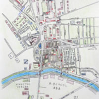
My map is a pretty accurate top-view rendition of how the Harvard Square area actually looks like. The places that I’m most inaccurate in drawing are places that I rarely visit (business school and the athletic fields, parts of the quad). I think the…
Tiffany Lopinsky

This assignment has illuminated that it’s easy for me to clearly picture small segments of the square, but it’s difficult for me to put it all together into one cohesive unit. The largest difference between my map and reality is how the CGIS and GSD…
Tianyu Liu
I'm generally happy with the final product, but here're some difference I noticed with the real map: 1. I misrepresented the triangle area around Cambridge common. With that, the size of science center and law school are both very off. 2. I missed…
Katja Lierhaus
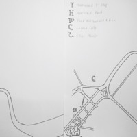
I chose to do the most familiar path that I know of today: my route to class. I begin at Eliot House (bottom left corner of the sketch labeled with a cursive ‘E’) and I travel upward toward Harvard Yard (designated by the ‘H’). I then travel around…
Yao Li
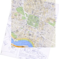
The placement and proportion of the buildings within Harvard yard are fairly accurate on my map, probably because they’re enclosed in a square block (and then are located in specific geometric subdivisions within that block). This orientation helps…
He Li
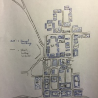
The main difference between my sketch and reality is that my sketch is a lot more grid-like, while the actual layout of Harvard Square has far more curved roads and diagonally-aligned buildings. For example, the engineering and law school portions of…
Electra Lang
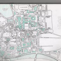
It’s immediately obvious, looking at my map, that my knowledge of Harvard is very much concentrated on the Square and the Yard and as one gets further towards the periphery of the campus and surrounding area, my knowledge rapidly diminishes. While…
Alma Lafler
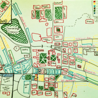
My map is accurate enough that it could help a tourist get around the included parts of town with little trouble. I commute around campus by bicycle and am very familiar with the road network around Harvard, which would likely make it different from…
Pearly Kim
Compared to the actual map, the relative positions of the buildings and sites I labeled on the map are close to being accurate, but the scales and relative sizes are quite off. The most notable differences are the relative sizes of different blocks,…